RoofOfRock web and mobile applications
Matija Krivic, Tadej Fius, Luca Zini, Alessio Mereu


Matija Krivic, Tadej Fius, Luca Zini, Alessio Mereu
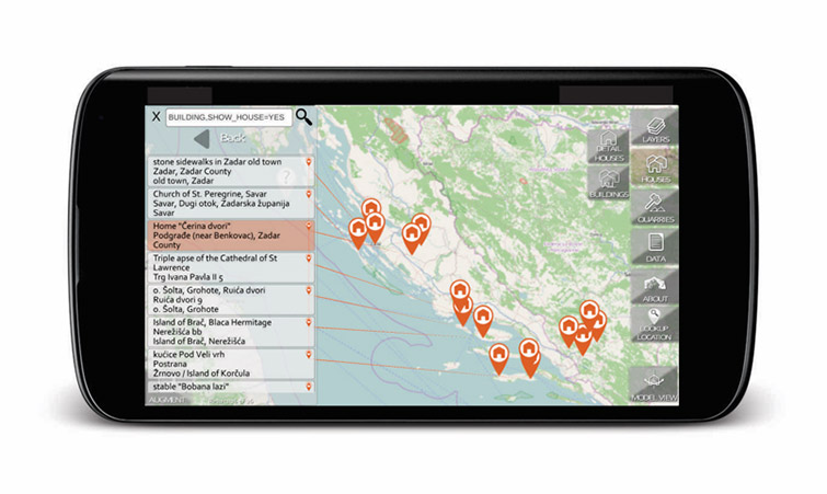
The RoofOfRock application enables users to explore geological data, map layers, locations of houses and quarries and view selected 3D models of houses along with connected house elements. Users can select, view and call up additional map layers, like geological units, platy limestone, Natura 2000 and many more. A dynamic list on the side displays current items that can be linked to marked locations on the map or 3D model. Pressing an item in the list displays detailed information. Pressing on a marker highlights item in the dynamic list and displays detailed information. Houses displayed in model view can be rotated and zoomed. Connected house elements are interactive; pressing on a model part displays additional information and highlights the item in the dynamic list.
The application requires internet access, and works on the majority of smart devices (phones/tablets). Access to GPS service is optional, while devices supporting motion sensors i.e. compass, accelerometer, gyroscope and similar enable additional features. 3D graphic requirements: Android: OpenGL ES 2.0, Apple: OpenGL/Metal, Windows Phone: DirectX.