RoofOfRock web and mobile applications
Matija Krivic, Tadej Fius, Luca Zini, Alessio Mereu


Matija Krivic, Tadej Fius, Luca Zini, Alessio Mereu
The data stored in a project’s joint geodatabase serves as a basis for different applications developed for the RoofOfRock project. All share a common purpose, which is to show the results of the project. The applications show the correlation between natural and cultural heritage through the use of platy limestone as a building material.
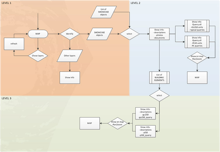
All applications largely follow the same workflow, representing said correlation through a single common entry point—the studied showcase objects. The workflow is divided into 3 levels. The first general level allows the user an overview of different data. In the second level the user can choose one of the studied showcase objects and view basic information on it. The final level shows the spatial and geological origin of the construction material, namely limestone, of selected object elements. The workflow is depicted below (Fig. 6.3).